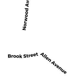
25 NORWOOD AV
Owner Information
LOGUE TIMOTHY J
P O BOX 419
MANCHESTER, MA 01944


Property Details
25 NORWOOD AV is classified as a Single Family Residential (Old style).
The primary structure on this property was built in 1900. There are 2,464ft2 of built area within this property. There is 2,464ft2 of residential/living space within this property. This property is listed as having 7 rooms.
25 NORWOOD AV is valued at $748,300. The land is valued at $352,500 and the structures are valued at $387,900. There is an additional valuation of $7,900 on this property.
This property is in Zone G. Confirm with local Zoning Board authorities to ensure there are no overlays or other easements on this property.
25 NORWOOD AV was last sold on Monday, August 3, 1992 for $192,000.
Assessment data from fiscal year 2022.
Flood Data
According to the FEMA National Flood Hazard Layer, this property does not appear to be in a flood zone. It may also be in an area not yet reviewed. Nonetheless, confirm this information prior to taking any action.
To view the flood hazards around this property, create a FEMA "Firmette" Map of the area around 25 NORWOOD AV.
Broadband Internet Providers
| Provider | Type | Bandwidth (mbps) | |
|---|---|---|---|
| VSAT Systems, LLC. | Satellite | 2 | 1 |
| HughesNet | Satellite | 25 | 3 |
| GCI Communication Corp. | Satellite | 0 | 0 |
| T-Mobile | Fixed Wireless | 25 | 3 |
| Comcast | Cable | 1000 | 35 |
| Verizon New England Inc. | DSL | 15 | 1 |
| Viasat Inc | Satellite | 100 | 3 |
Broadband service provider data from December 2020.
Adjacent Properties
- 27 A NORWOOD AV
Residential Condominium owned by BARBARA J. WILSON REVOCABLE TR - 27 B NORWOOD AV
Residential Condominium owned by CAPRA KELLY J - 27 C NORWOOD AV
Residential Condominium owned by JOHNSON THOMAS H. - 27 D NORWOOD AV
Residential Condominium owned by ARCHES REALTY TRUST - 27 E NORWOOD AV
Residential Condominium owned by GREENWOOD ERIN KEMP - 27 G NORWOOD AV
Residential Condominium owned by ALAN KARAHALIS REALTY TRUST - 27 H NORWOOD AV
Residential Condominium owned by PAULA KARAHALIS REALTY TRUST - 27 F NORWOOD AV
Residential Condominium owned by MILNE SCOTT - 21 NORWOOD AV
Single Family Residential owned by OLIVER CHRISTOPHER V. - 23 NORWOOD AV
Single Family Residential owned by OLIVER CHRISTOPHER - 50 SUMMER ST
General Office Buildings owned by SC 50 SUMMER ST, LLC